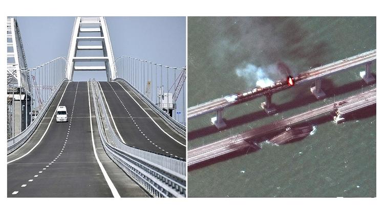
Satellite images show the explosion that destroyed part of the bridge connecting Crimea to Russia. The explosion occurred this Saturday (8).
Built in 2018, the structure is strategic for Russia as it is the only link between the country’s territory and Crimea, which belongs to Ukraine but was annexed by Vladimir Putin’s government in 2014.
Built at a cost of US$3.6 billion, the bridge is 17 km long and was the longest in Europe when completed.
The Russian government built a structure for cars and a railway line next to it.
As a result of the crash, two lanes for cars were knocked down, but Russian officials say traffic has already partially resumed.
See before and after the bridge
Who blew up the bridge? Neither Russia nor the Ukrainian government claimed responsibility for the attack, while Ukrainian officials applauded the explosion on social media. Ukrainian President Volodymyr Zelensky has not yet spoken.
echo. The blast put ambassadors, negotiators and governments on high alert. Sources in Moscow told UOL columnist Jamil Chad that the perspective of many observers and even intelligence services in the face of the attack is that President Vladimir Putin will have to react.
“Putin cannot and will not let this go,” said a senior diplomat in the Kremlin. There are doubts as to whether the attack would be classified by the Russians as an example of a threat to national territory.
source: Noticias
