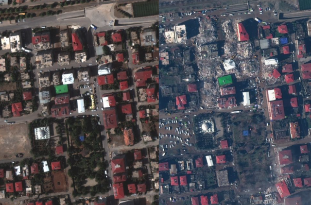
Satellite images of the city of Turkey before and after the earthquake in Turkey and Syria have been released. A white first-aid tent was erected in the place where private houses and tall buildings collapsed.
According to the US CNN, on the 7th (local time), the US satellite image company ‘Maxa Technologies’ released satellite images of the city of Turkiye before and after the earthquake on social media.
Dozens of buildings three to five stories tall were destroyed. The two large buildings located near the mosque collapsed without shape. Remnants of collapsed buildings were piled up on the streets, and bulldozers were also seen removing them.
 The city of Turkiye on October 4, 2022 (left) and February 7, 2023 (local time). Captured from Maxar Technologies Twitter (@Maxar)
Dozens of tractor trailers were carrying out relief work in the residential areas and roads of Nurdagi village in the north of Turkiye. The ‘Great Garden’, the town’s central park, is now filled with first aid tents for survivors and first responders. Dozens of tents have been set up on the west side of the village, near the government building.
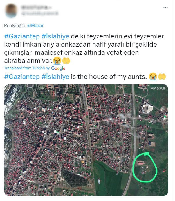
 A netizen left a comment saying, “This is my aunt’s house” on a photo before and after the earthquake in Turkey and Syria posted by Maxa Technologies. Captured from Maxar Technologies Twitter (@Maxar)
Netizens who came across this responded with comments such as “We need images of the Syrian region” and “The more images there are of various places in the region, the more accurate the rescue will be.” There was also a request, “Can you take a picture of what happened to this address area?”
Maxa Technologies said through SNS, “We will immediately release newly acquired photos on SNS,” and “Anyone can check the photos through the official website open data program.”
On the 6th (local time), a 7.8 magnitude earthquake struck Turkey and Syria. According to AFP, the number of deaths counted so far was 5,894 in Turkiye and 2,470 in Syria, for a total of 8,364 deaths. Rescue efforts are still ongoing by Turkiye search crews and volunteers from around the world.
Lee Ye-ji,
Source: Donga
Mark Jones is a world traveler and journalist for News Rebeat. With a curious mind and a love of adventure, Mark brings a unique perspective to the latest global events and provides in-depth and thought-provoking coverage of the world at large.